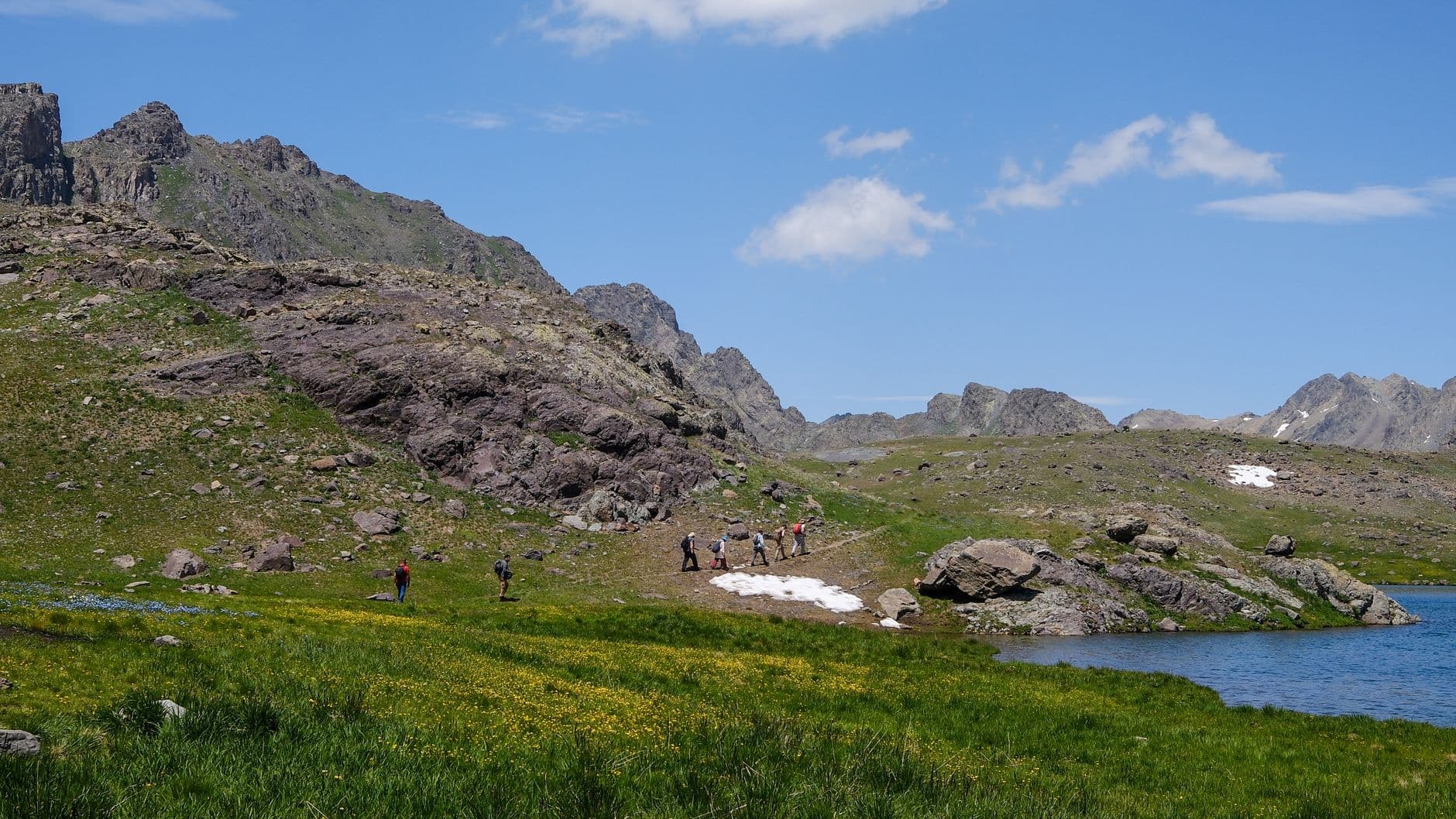
Summary: With its high altitude, harsh climate, and technical terrain, the Eastern Anatolia region offers challenging yet rewarding camping routes for trail running tailored for intermediate runners. Success on routes like Munzur, Nemrut Crater, and Mount Süphan depends on proper altitude acclimatization, selecting lightweight camping gear resilient to sudden temperature drops, and strategic hydration. This guide provides a technical analysis of the region's trails and practical ways to combine camping with running.
Camping Routes for Trail Running and High-Altitude Dynamics in Eastern Anatolia
If you have gained enough experience as an intermediate trail runner on forest trails or low-altitude routes, the next logical step is to increase your elevation and transition to multi-day activities. At this point, when searching for camping routes for trail running, Eastern Anatolia emerges as the most technical, isolated, and physically demanding region you will encounter. The region's defining characteristics—starting elevations above 2000 meters, sharp day-night temperature fluctuations, and volcanic/rocky terrain—directly impact your running performance while forcing you to optimize your camping setup into a more durable and lightweight system.
What You Will Learn in This Article
- Technical terrain and gradient analyses of specific trail routes in Eastern Anatolia.
- Post-run recovery strategies in high-altitude camps.
- Choosing lightweight gear suitable for extreme day-night temperature differences.
- The status of water sources in the region and strategic hydration planning.
- Adjusting your camping and running pace to prevent altitude sickness.
The Basics of Combining Running and Camping at High Altitudes
Combining running and camping in Eastern Anatolia is a much more complex physiological adaptation process than simply throwing a tent into your backpack. On routes above 2500 meters in Eastern Anatolia, oxygen levels are 25% to 30% lower than at sea level. This means your usual VO2 max values will drop directly, and your heart rate will peak much faster while running at your accustomed pace. You must use camping as a recovery tool in this process. When you reach the campsite after a run, changing into dry layers before your body temperature drops rapidly and replenishing your muscle glycogen stores within the first 30 minutes will determine your running performance for the next day.
Review of Eastern Anatolia's Technical Trail and Camping Routes
Although there are hundreds of kilometers of interconnected shepherd trails in the region, three main routes stand out for intermediate runners in terms of campsite proximity to water sources and logistical accessibility.
Munzur Mountains Crossing (Ovacık - Mercan Valley)
Starting from Ovacık, Tunceli, and extending to the Mercan Valley, this route is characterized by sharp limestone cliffs and deep glacial lakes. Averaging between 2400 and 3200 meters, the terrain on this route is highly technical. Scree (loose rock) crossings will challenge your ankle stability. The Karagöl or Şahverdi plateaus are ideal camping spots. Water sources are abundant in these areas, but since the water comes from glacial melt, its mineral (electrolyte) value is low; you must add electrolyte tablets to your water during your run.
Nemrut Crater Lake Surroundings (Bitlis)
Nemrut, Turkey's largest crater lake, offers the opportunity to run along a 2900-meter ridge line around the caldera, starting from campsites at an altitude of 2200 meters. The terrain consists largely of volcanic tuff and pumice stone. This surface structure can reduce the grip of your shoes' lugs. Wind intensity on the caldera ridge is high. You can protect yourself from the wind by setting up your camp by the lake inside the crater and then climb the ridge in the early morning to complete your run.
Foothills of Mount Süphan (Aydınlar Town - Kışkıllı)
Starting from the village of Kışkıllı and extending to the At Plateau at 2800 meters, this route features long and steady climbs. The terrain consists of volcanic ash and large basalt blocks. This area offers a perfect gradient for those looking to do long-distance (ultra) climbing training. The At Plateau is used as a campsite; however, due to sparse vegetation, the camp's protection from sun and wind depends entirely on the system you set up (tarp/bivy or a sturdy tent).
5 Tactics for Trail Running and Camping at High Altitudes
Lightening the logistical and physical load of your activity is the fundamental rule for surviving and enjoying the unforgiving geography of Eastern Anatolia.
- Insulation Material Comparison: Compared to down sleeping bags, synthetic-filled bags retain up to 70% of their insulating properties even if they get wet in Eastern Anatolia's sudden dew and rain. For a sleeping bag that you will carry in your running pack alongside sweaty clothes, choose synthetic or hydrophobic-treated down.
- Calorie Planning: According to research, the body's calorie consumption during trail runs at an altitude of 3000 meters is 200-300 kcal higher per hour compared to sea level. Opt for high-calorie dehydrated meals, maintaining a carbohydrate-to-protein ratio of 3:1 or 4:1 in your camp meals.
- Smart Layering: It is essential not to sweat excessively during the run and not to get cold at camp. Merino wool base layers provide moisture transfer and can be worn for days without washing or retaining odors. A lightweight Gore-Tex jacket to block the wind after your run and a packable synthetic puffer jacket for camp are must-haves.
- Foot Care and Shoe Selection: Volcanic terrain wears out your shoes quickly. Choose wide-toe running shoes with a rock plate. Taking off your running shoes and switching to ultra-lightweight camp slippers once you reach the campsite will reduce foot swelling and allow your feet to breathe.
- Route and Pace Discipline: Do not try to hit your sea-level pace with first-day excitement. Acclimatize to the altitude by keeping your heart rate in Zone 2 (60-70% of your maximum heart rate).
Critical Mistakes Made in High-Altitude Running and Camping
The most common mistakes made by intermediate runners usually stem not from physical capacity, but from misreading environmental conditions.
1. Skipping Acclimatization: Driving up to 2500 meters on the first day and immediately starting a run increases the risk of Acute Mountain Sickness (AMS). Headaches, nausea, and extreme fatigue can turn your night at camp into a nightmare. The right approach is to spend the first day just doing a light hike and setting up camp, saving the run for the second day.
2. Wrong Tent Selection: Bringing fully meshed summer (3-season) tents to Eastern Anatolia to save weight is a huge mistake. The night wind will instantly sweep away the warm air inside the tent. Lightweight 3-4 season tents with high fabric panels and strong wind resistance should be used.
3. Ignoring Microclimates: There can be a 10-15 degree temperature difference between the valley floors and the ridge lines. While running on the ridge, wind chill can cause your sweat to dry rapidly on your body, leading to the onset of hypothermia. Always keep an easily accessible windbreaker with you.
Safety and Risk Management on Eastern Anatolia Routes
The region's wildlife (especially brown bears and wolves) is active. Never keep your food inside your tent at the campsite. Store food and scented trash by hanging them on a tree branch (bear bag) at least 100 meters away from your tent. Additionally, cell phone signal is unavailable on 80% of the routes. Therefore, preload your routes onto your running watch (Garmin, Suunto, etc.) in GPX format, and always carry an emergency blanket, a whistle, and a first aid kit. Back up your navigation by downloading offline map applications to your phone.
3 Vital Facts You Need to Know Before Going to Eastern Anatolia
- Logistical and Transportation Difficulties: Reaching the trailheads via public transport is often impossible. Renting a local vehicle or making prior arrangements with village cooperatives is key to the activity.
- Seasonality of Water Sources: Many riverbeds visible on the map dry up completely starting in August. Planning your activity between late June and mid-July maximizes your chances of finding water.
- Temperature Amplitude Between Day and Night: On the same day, you might run under the midday sun at 25°C and experience -5°C in your tent at night. Your gear setup must be flexible enough to tolerate this 30-degree difference.
Frequently Asked Questions
What are the best months for trail running in Eastern Anatolia?
High-altitude snow in the region usually does not melt until mid-June. Therefore, the safest and most suitable period in terms of terrain is the timeframe between late June and mid-September.
How can post-run recovery be accelerated when camping at high altitudes?
Change into dry clothes as soon as you finish your run, and consume a liquid/semi-solid meal rich in carbohydrates and protein within the first 30 minutes. Soaking your feet in a cold water source for 5-10 minutes (cold therapy) will reduce inflammation.
What precautions should be taken at the campsite against the danger of bears?
Cook your meals at least 50 meters away from your tent. Hang all food, trash, and scented items like toothpaste in airtight bags away from your tent, or use bear canisters.
Are the water sources on the region's routes reliable?
High-altitude glacial waters and springs are generally clean but carry a risk of fecal contamination due to livestock activities. Always consume your water by purifying it with a water filter (e.g., Sawyer or Katadyn) or by boiling it.
How many kilometers a day should an intermediate runner aim for at high altitudes?
A daily running effort of 20 km at sea level is equivalent to 12-15 km at 3000 meters in Eastern Anatolia. Considering the technical terrain and altitude, a daily target of 10-15 km is realistic and safe.
Final Words and Hitting the Trail
Eastern Anatolia is a tremendous laboratory that will test your standard running and camping routines and take you to the next level. Calculating your steps on the jagged rocks of Munzur, controlling your breath in the windy caldera of Nemrut, and setting up camp on the volcanic slopes of Süphan is not just a physical workout, but also a test of mental endurance. Respect the altitude, choose your gear rationally according to the region's conditions, and adapt to the rhythm of nature. If you have decided where the trails will take you, it is time to lighten your packs and enjoy this challenging geography.